Thomas Gillespie
Thomas Gillespie
Professor
Ladder Faculty
Office: 1255 BUNCHE HALL
Email: TG@GEOG.UCLA.EDU
Phone: 51818
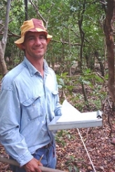
Biography
(Ph.D., UC Los Angeles, 1998) is a Professor with research interests in Geographic Information Systems (GIS), Remote Sensing, and Biogeography. Professor Gillespie leads the EOS seminars and teaches classes in remote sensing and the geography of the tropics.
Education
Ph.D. University of California, Los Angeles, 1998 Department of Geography M.A. California State University, Chico, 1994 Department of Geography and Planning B.A. University of Colorado, Boulder, 1990 Department of International Affairs
Research
My past research interests have focused on using geographic information systems (GIS) and remote sensing data for predicting patterns of species richness and rarity for plants and birds at a regional spatial scale.
Biodiversity Research
My botanical research will continue to focus on surveying tropical dry forests in biodiversity hotspots. I have collected floristic data from Wallacea, Sundaland, Indo-Burma, Mesoamerica, New Caledonia, and Caribbean hotspots and within four years, I will collect data from a number of other tropical dry forests in biodiversity hotspots. This research is field intensive and taxonomically challenging but provides comparative floristic and structural data for regions where relatively little information exists. This research will result in a number of publications on global conservation priorities, natural resource management, and tropical ecology and will be used as ground truth data for remote sensing studies of anthropogenic disturbance and estimates of forest biomass.
My faunal research has focused predominately on tropical bird communities, but I have published papers on mammal and herpetofauna diversity. My long-term research agenda for fauna will focus primarily on combining detailed natural history and field data with remote sensing data to model species distributions and probability of extinction in fragmented landscapes. Models of species distributions will also be examined for a number of environmental change scenarios to predict the future distribution of species.
Remote Sensing Research
My remote sensing research is divided into airborne and spaceborne sensors that can be used to measure and monitor terrestrial vegetation. My spaceborne sensor research focuses specifically on high-resolution data from Landsat and IKONOS satellites to test hypotheses on the utility of these sensors for predicting floristic composition and structure in fragmented landscapes and to develop new algorithms that predict the distribution and abundance of endangered species. Advances in geographic information systems and remote sensing techniques have resulted in a number of landscape metrics and indices that may be used to predict the distribution of species richness in habitat fragments. I am currently testing the utility and accuracy of landscape metrics and remote sensing indices for predicting patterns of woody plant species richness and rarity in tropical dry forests of south Florida and Oceania. In particular, I focus on testing the accuracy of landscape metrics within three fragmented systems: anthropogenic fragments, natural habitat fragments, and true islands. The long-term goal is to develop algorithms that predict the distribution of plants and endangered species in other tropical dry forest regions and California ecosystems.
Selected Publications
Dimson, M., Cavanaugh, K. C., von Allmen, E. Burney D. A., Kapua Kawelo, K., Jane Beachy, J., and Gillespie, T.W. 2024. Monitoring native, non-native, and restored tropical dry forest with Landsat: A case study from the Hawaiian Islands. Ecological Informatics, p.102821.
MacDonald, Z. G., Schoville, S., Escalona, M., Marimuthu, M.P., Nguyen, O., Chumchim, N., Fairbairn, C.W., Seligmann, W., Toffelmier, E., Gillespie, T. and Shaffer, H.B. 2024. A genome assembly for the Chryxus Arctic (Oeneis chryxus), the highest butterfly in North America. Journal of Heredity, p.esae051.
Bardou, R., Friess, D.A., Gillespie, T.W., and Cavanaugh, K.C. 2024. Assessing mangrove cover change in Madagascar (1972 to 2019): Widespread mangrove deforestation is slowing down. Global Ecology and Conservation 53, e03022.
Slik, F., et al. 2024. Wind dispersed tree species have greater maximum height. Global Ecology and Biogeography e13878
Ocón, J.P., Stavros, E.N., Steinberg, S.J., Robertson, J. and Gillespie, T.W. 2024. Remote sensing approaches to identify trees to species-level in the urban forest: A review. Progress in Physical Geography: Earth and Environment 48(3), 438-453.
Fortini, L.B., Kaiser, L., Daehler, C. Jacobi, J., Dimson, M. and Gillespie, T. 2024. Exploring and integrating differences in niche characteristics across regional and global scales to better understand plant invasions in Hawaiʻi. Biological Invasions 26, 1-17.
MacDonald, Z.G., Gillespie, T. and Shaffer, H.B. 2024. The highest butterfly in North America. Frontiers in Ecology and the Environment 22 (1), e2707.
Dimson, M., Fortini, L.B., Tingley, M.W. and Gillespie, T.W. 2023. Citizen science and professional surveys offer complementary data for understanding invasive plant distributions. Diversity and Distribution 29. DOI:10.1111/ddi.13749.
Gallerani, E.M., Burgett, J., Vaughn, N., Fortini, L.B., Fricker, G.A., Mounce, H., Gillespie, T.W., Crampton, L., Knapp, D., Hite, J.M. and Gilb, R. 2023. High resolution lidar data shed light on inter-island translocation of endangered bird species in the Hawaiian Islands. Ecological Applications e2889.
Dong, C., Yan, Y., Guo, J., Lin, K., Chen, X., Okin, G.S., Gillespie, T.W., Dialesandro, J., and MacDonald, G.M. 2023. Drought-vulnerable vegetation increases exposure of disadvantaged populations to heatwaves under global warming: A case study from Los Angeles. Sustainable Cities and Society 93, 104488.
Dimson, M. and Gillespie, T.W. 2023.Who, where, when: Observer behavior influences spatial and temporal patterns of iNaturalist participation. Applied Geography 153, 102916.
Madson, A., Dimson, M., Fortini, L.B., Kawelo, K., Ticktin, T., Keir, M., Dong, C., Ma, Z., Beilman, D.W., Kay, K. Ocón, J.P., Gallerani, E., Pau, S. and Gillespie, T.W. 2022. A near four-decade time series shows the Hawaiian Islands have been browning since the 1980s. Environmental Management 22, 1-16.
Rocchini, D., Santos, M.J., Susan L. Ustin, S.L., Feret, J-B., Asner, G.P., Beierkuhnlein, C., Dalponte, M., Feilhauer, H., Foody, G.M., Geller, G.N., Gillespie, T.W., He, K.S., Kleijn, D, Leitao, P.J., Malavasi, M. Moudry, V., Jana Mullerova, V., Nagendra, H., Normand, S., Ricotta, C., Schaepman, M.E., Schmidtlein, S., Skidmore, A.K., Petra Simova, P., Torresani, M. , Townsend, P.A., Turner, W., Vihervaara, P.,Wegmann, M., and Lenoir, J. 2022. Diamonds in the sky: the spectral species concept in living color. Journal of Geophysical Research–Biogeosciences 127(9), e2022JG007026.
Dong, C., Williams, A.P., Abatzoglou, J.T., Lin, K., Okin, G.S., Gillespie, T.W., Long, D., Lin, Y.H., Hall, A. and MacDonald, G.M. 2022. The season for large fires in Southern California is projected to lengthen in a changing climate. Communications Earth & Environment 3(1), 1-9.
Grants & Awards
National Institute of Aging
‘Evolution of well-being among older adults after a disaster’ Co-Principal Investigator, Five years, $2,237,670
Environmental Protection Agency, STAR grant
‘Creating sustainable indicators to asses the physical, social, and economic values of greening cities: A study of the million tree initiative in Los Angeles, CA’
Co-Principal Investigator, Three years, $299,985
National Institute of Child Health and Human Development ‘California Center for Population Research’ Co-Principal Investigator, Five years, $3,167,479
MacArthur Foundation ‘Enhancing Population-Based Surveys with Satellite Imagery and Geographic Information Systems’
Co-Investigator, $86,000
NASA Earth and Space Science Fellowship
‘Estimating species richness and structure of Hawaiian Dry Forest using Terra ASTER’
Principal Investigator (Co-Principal Investigator, Pau) $45,920
National Science Foundation: Program of Human and Social Dynamics
‘Social, Economic, and Physical Effects of a Natural Disaster’
Co-Principal Investigator, Four years, $726,078
National Science Foundation: Geography and Regional Studies
‘Remote Sensing, Biogeography, and Conservation of Tropical Dry Forests
in Pacific Biodiversity Hotspots.’ Principal Investigator, Three years, $64,767
